
Pictures
without time / date can be clicked on for a larger image - thanks to
Jane O'Neill for supply of some digital images
Day
6, 30th November 2000 - Gunnedah to Gunnedah, 350 kms, Two non-severe
storms.
"QUIRINDI..WE
HAVE A PROBLEM"
Today was a funny day. By 11am it was evident
that the trough had reversed back SW, a not unusual situation, but one
that we had not figured on. We drove from Gunnedah to the Quirindi lookout.
Unlike yesterday activity was very slow to get going, even by 1pm there
were no local storms. We could hear sparking on the AM radio and with
the aid of binoculars could see a line of weak storms far the the west,
at least 3-4 hours drive away. After one of Jane's famous roadside cups
of freshly brewed tea we finally decided to make a move southwards into
the Hunter Valley. Whilst doing so the first congestus towers went up
over the Liverpool ranges back behind us. We could also see large congestus
far to the south, perhaps inland of the Central coast.
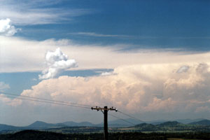 At
the town of Scone we refueled and had a discussion as to what area to
target. Two chase crews had already committed themselves to the Hunter
action. Higher dewpoints, but lower surface temperatures was their gamble.
The storms back behind us had matured, but we also knew that similar
to yesterday we would be trading dew points for hotter surface temperatures.
Buoyed by yesterday's success we decided to reverse tracks the 90kms
back to Quirindi. At
the town of Scone we refueled and had a discussion as to what area to
target. Two chase crews had already committed themselves to the Hunter
action. Higher dewpoints, but lower surface temperatures was their gamble.
The storms back behind us had matured, but we also knew that similar
to yesterday we would be trading dew points for hotter surface temperatures.
Buoyed by yesterday's success we decided to reverse tracks the 90kms
back to Quirindi.
ANVILUS
MAXIMUS
During
the drive the storms rapidly matured and anvils spread across the western
sky. Back at the Quirindi lookout we again had a decision to make, the
storms to the west had that ' anviled out ' look, whilst to our north
massive towers had built on the Northern Tablelands. We decided on a
move north to Tamworth, that way keeping us in contact with both systems.
We were still undecided so we contacted Michael Bath for a radar and
lightning tracker update. The update revealed that the storms over the
Northern Tablelands had higher rainfall rates, but the ones behind the
anvils westward had more lightning activity. We chose the ones westward.
As we approached the rear of the storms there were some CG's, but it
soon became apparent this system was decaying.
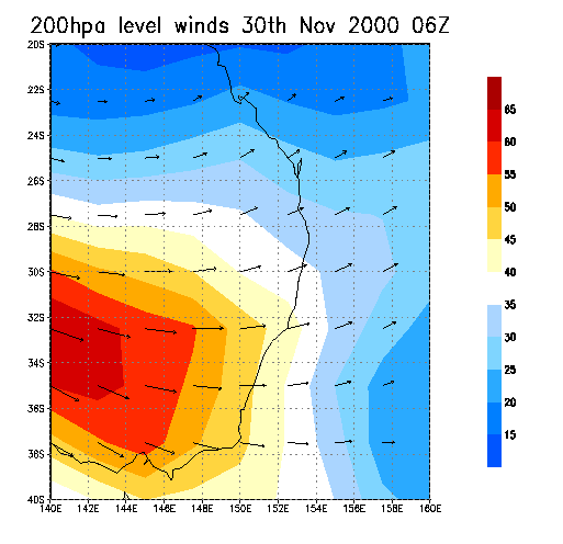
The
problem today was that there was enough jet stream to spread the anvils
many kilometres down stream of the storms, but not enough jet stream
to disperse the anvils quickly, resulting in large areas being shadowed
by anvil cloud, killing convection. Behind the weak storm line and back
into sunshine we could see some congestus towers growing west of Gunnedah,
we headed that way and around sunset encountered a small but electrically
active storm.
TO
NEXT DAY
MAPS
AND STUFF
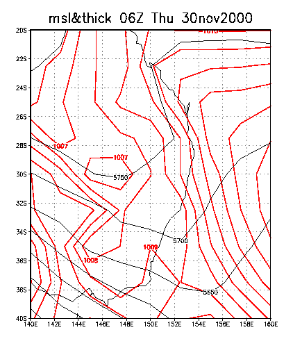
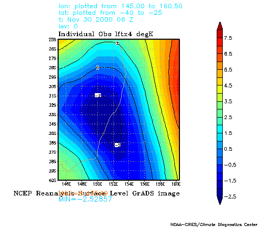
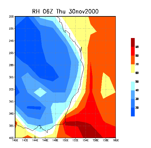
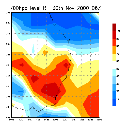
A deep
trough persisted through New South Wales. In many ways it should have
been a better day and severe storms were active in many parts of the
state. The ideal target area would have been further south and closer
to the coast.
  
|